Boundary Surveys
Boundary Verification Before Work Begins
Unverified boundary lines create unnecessary risk during development, permitting, construction, and property transfer coordination. When boundaries have not been field-verified, disputes, encroachments, and project delays become much more likely.
Backcountry Land Surveys provides boundary surveys for developers, attorneys, title professionals, contractors, and property stakeholders.
Each survey combines recorded deed research, field investigation, monument recovery, and professional documentation prepared to support permitting, title review, development planning, and legal documentation requirements.
What Boundary Surveys Establish
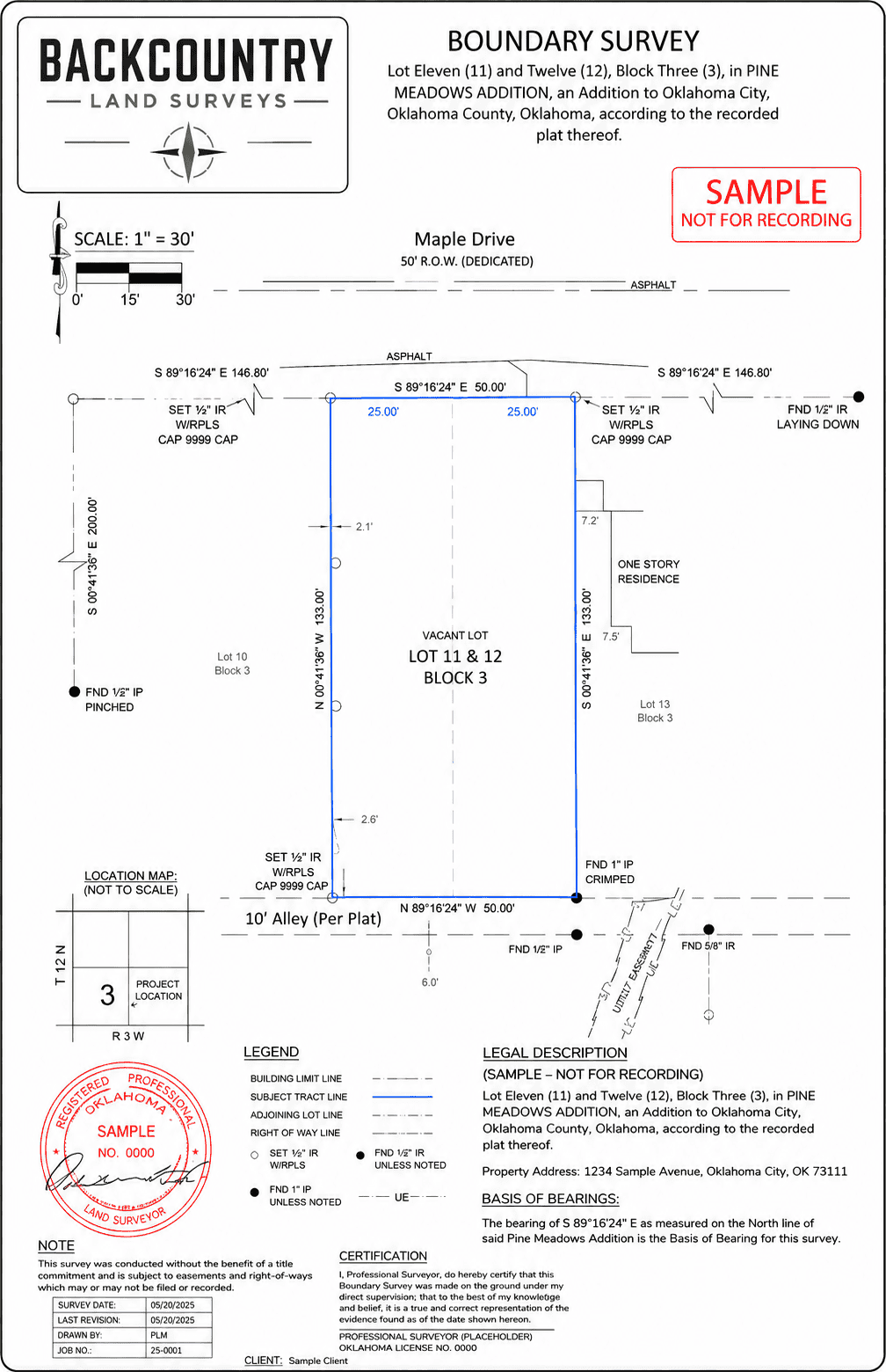
Boundary surveys verify legal parcel limits using recorded documentation and field-observed evidence.
Where field conditions differ from recorded information, those conditions are documented clearly for your review and coordination.
When Boundary Verification Matters
Boundary surveys are commonly required before development, permitting, construction, transfer, or legal review moves forward.
Boundary verification early in the project cycle helps prevent expensive revisions and avoidable delays later.
What Our Boundary Surveys Deliver
Every boundary survey is completed by a licensed Professional Land Surveyor and prepared for professional use across permitting, title, legal, and development workflows.
We coordinate directly with attorneys, engineers, contractors, title professionals, and project stakeholders throughout the process.
Documentation for Project Decisions
Boundary documentation becomes part of permitting files, legal records, title coordination, and development planning. Accuracy, clarity, and professional accountability matter.
Every survey from Backcountry Land Surveys is signed and sealed to applicable Oklahoma and Texas standards by a licensed Professional Land Surveyor.
Frequently Asked Questions - Boundary Surveys
Boundary verification is especially important before permitting, construction, land acquisition, subdivision, site development, or resolving potential encroachment issues.
A boundary survey establishes legal parcel boundaries through research and field verification. A mortgage inspection report is a visual site observation used primarily for lending documentation. Only a boundary survey should be used for construction, permitting, or dispute resolution.
Yes. Property corners are typically recovered or set during the survey process and documented on the final plat.
Yes. Boundary surveys are frequently used during title review, legal coordination, development planning, and dispute resolution processes.
Turnaround depends on parcel size, deed research complexity, accessibility, terrain conditions, and overall project scope.
Yes. Backcountry Land Surveys coordinates boundary surveys throughout Oklahoma, Texas, Arkansas, Missouri, Kansas, Colorado, New Mexico, Arizona, Utah, Nevada, California, Oregon, Washington, and Idaho, depending on project scope, site location, and documentation requirements.
Clarify Boundaries Before Work Begins
Share a few details about the site, project timeline, and boundary requirements, and our team will follow up by the next business day.

Professional land surveying services supporting lending, development, construction, and transactional workflows.
Services
Company
© 2026 Backcountry Land Surveys