Topographic Surveys
Field Data That Supports Design and Development
Design decisions are only as reliable as the field data behind them. When grading, drainage, utility planning, or site layout is based on outdated or incomplete information, revision cycles and construction conflicts become much more likely.
Backcountry Land Surveys provides topographic surveys for engineers, architects, developers, municipalities, and contractors.
Our surveys are field-measured, CAD-compatible, and prepared to support engineering design, permitting coordination, development planning, and construction workflows from the beginning of the project.
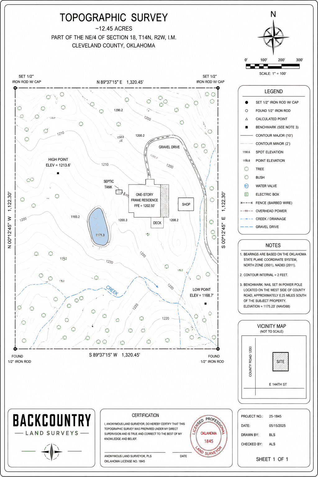
What Our Topographic Surveys Capture
Our topographic surveys document existing site conditions and elevation characteristics needed for planning and design.
Survey scope can be configured around your engineer, architect, municipality, or project requirements.
Who Relies on Topographic Surveys
Topographic surveys support multiple disciplines throughout development and construction workflows.
The earlier accurate topo data enters the workflow, the more efficiently project teams can plan and coordinate.
What Our Topographic Surveys Deliver
Backcountry Land Surveys provides organized, field-verified topographic documentation prepared for engineering and development use.
We coordinate directly with your engineering, architectural, and project management teams to support active project schedules.
Reliable Data Before Design Advances
Topographic surveys influence grading, drainage, layout, utility coordination, and construction planning. Reliable field data early in the process helps reduce redesign risk and supports more efficient project execution.
Backcountry Land Surveys delivers organized survey data your team can confidently build from.
Frequently Asked Questions - Topographic Surveys
Most projects use 1-foot or 2-foot contour intervals, depending on site conditions and engineering requirements.
Standard deliverables typically include DWG and DXF formats compatible with AutoCAD and Civil 3D workflows.
No. Topographic surveys document visible surface features and above-ground utility structures. Underground utility locating requires separate coordination.
Yes. Combined boundary and topographic surveys are common for development and construction projects and can improve scheduling efficiency.
Turnaround depends on acreage, terrain complexity, feature density, deliverable requirements, and project coordination needs.
Yes. Backcountry Land Surveys coordinates topographic surveys throughout Oklahoma, Texas, Arkansas, Missouri, Kansas, Colorado, New Mexico, Arizona, Utah, Nevada, California, Oregon, Washington, and Idaho, depending on project scope, site conditions, and development requirements.
Support Your Design Timeline
Share a few details about the site, development timeline, and survey requirements, and our team will follow up by the next business day.

Professional land surveying services supporting lending, development, construction, and transactional workflows.
Services
Company
© 2026 Backcountry Land Surveys